
What is this tool?
A web-based tool that converts Japanese address data into latitude and longitude (coordinates) through geocoding. It can batch-convert multiple addresses into GPS coordinates for use in map creation and location analysis.
Features
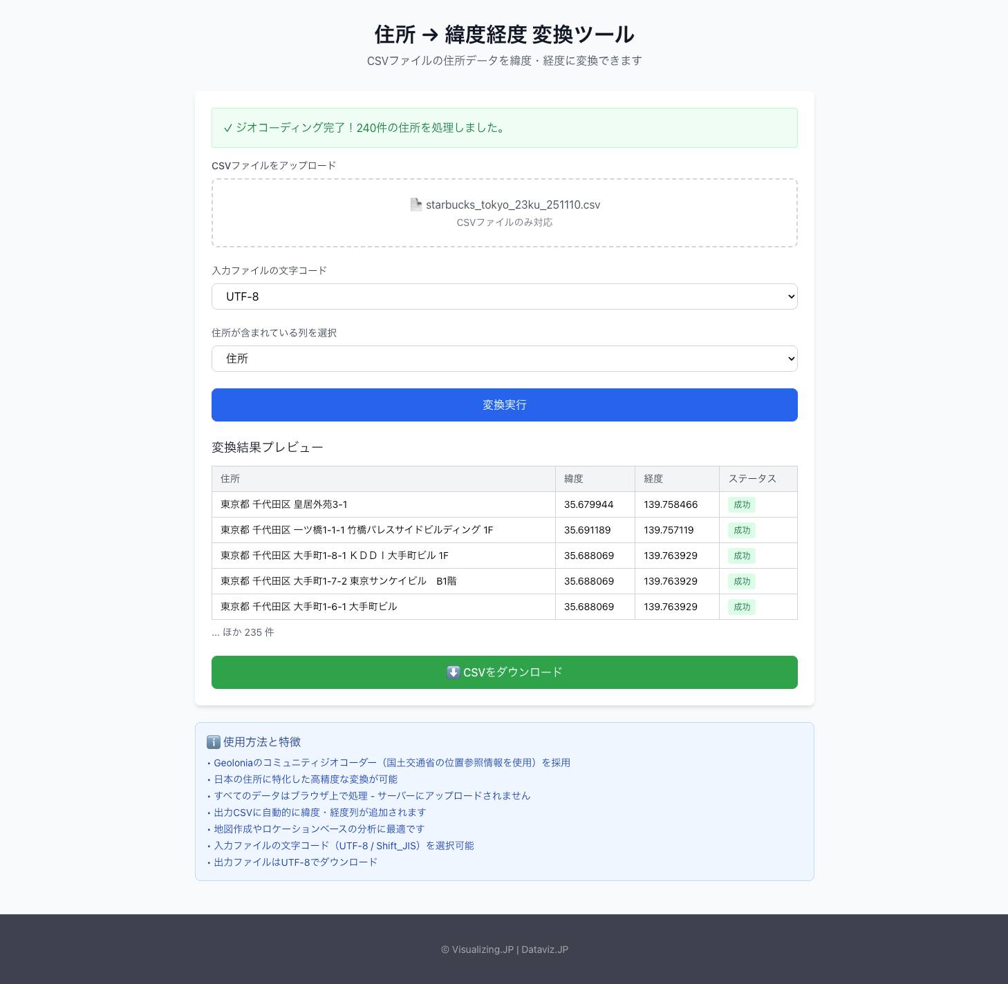
- Batch conversion (CSV support)…Upload a CSV file containing multiple addresses, and retrieve latitude and longitude for each address.
- High-accuracy geocoding…Uses Geolonia’s community geocoder (based on the Ministry of Land, Infrastructure, Transport and Tourism’s Address Reference Information), achieving conversion accuracy specialized for Japanese addresses.
- Character encoding support…You can specify the character encoding of the input file (UTF-8 / Shift_JIS).
- Browser-only processing…Data is processed entirely within the browser and is never sent to a server (privacy protection).
How to use
- Upload a CSV file…Load address data by clicking or drag-and-dropping a CSV file.
- Specify the character encoding…Select the appropriate encoding from UTF-8 / Shift_JIS.
- Run the conversion…A CSV file with automatically added latitude and longitude columns is generated.
- Download / Use…Download the output CSV and import it into map rendering or analysis tools.
Data formats
- Tabular data (CSV)